The BVHRefiner component - Refining and Loading hierarchical data dynamically
The BVHRefiner is a component that refines and loads hierarchical data dynamically during runtime. Two different dataset structures can be used (WMTS, TREE) that are described later.
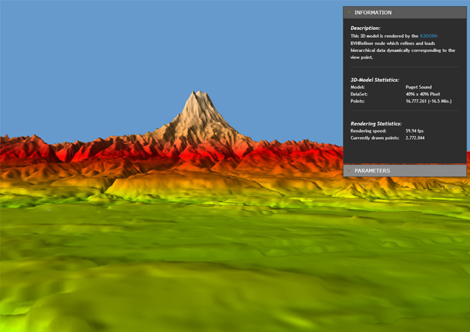
3D-Example of Puget Sound rendered with a WMTS conform dataset
<BVHRefiner maxDepth='5'
            minDepth='2'
            interactionDepth='4'
            subdivision='128 128'
            size='4096 4096'
            factor='10'
            maxElevation='410'
            elevationUrl="Puget Sound WMTS/elevation"
            textureUrl="Puget Sound WMTS/satellite"
            normalUrl="Puget Sound WMTS/normal"
            elevationFormat='png'
            textureFormat='png'
            normalFormat='png'
            mode="3d"
            submode="wmts">
</BVHRefiner>
Parameter descriptions
The following table lists the parameters currently supported:
Currently supported dataset formats
We support two different types of datasets. The first is based on WMTS specification and the second version is a folder based file arrangement. Both, the usage of WMTS and TREE for this BVHRefiner node are specified in the following subsections.
WMTS
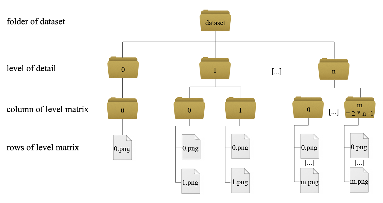
In WMTS (more information) a multidimensional dataset of a terrain can be integrated very easy. For every level of detail a new matrix of tiles is required. Every level has its own folder. So if you want to get five different levels of detail in your application, five folders must exist, numbered from 0 to 4. The detail from level to level grows up by a factor of four. Into the folders for the levels, subfolders that describe the columns of the matrix have to be inserted. On level 0 you only have one column, represented through the folder with the name 0. In the next level you have two columns named 0 and 1, growing up by a factor of two from level to level. In the subfolders you place the images that represent the tiles data. There must be as much images as subfolders. On level 0 you only have one image that represents the whole terrain data. On level one exist two subfolders. Every subfolder has to include two images, on the next level four per subfolder and so on. The following figure (figure 1) shows the addressing-scheme:
TREE
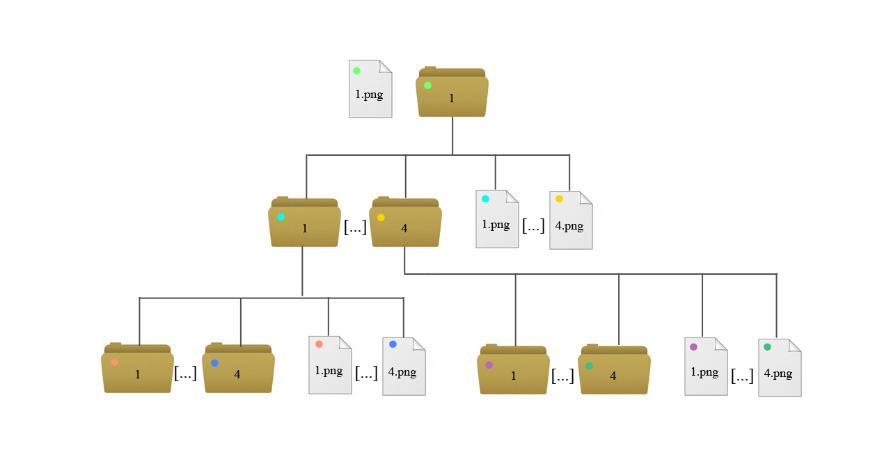
The TREE addressing-scheme is as easy as the WMTS addressing scheme. Every level in the tree defines a level of detail of the terrain. On level 0 we have an image (1.png) that represents the terrain in the worst quality. It has a folder that has its number as name (1). In this folder we find four images where all four images together represent the whole terrain. The resolution grows up every level by a factor of four. Every image has its folder that always includes four images with the next finer resolution quality. If an image has no folder, the final resolution quality has reached. The position of the images for a finer resolution is as follows:
- 1.png: top left
- 2.png: bottom left
- 3.png: top right
- 4.png: bottom right